























Swollen rivers, saturated catchments and disrupted connectivity explain the flooding in southern Odisha, highlighting the need for stronger river monitoring, localised warnings and post-cyclone preparedness
Bhaskar Parichha
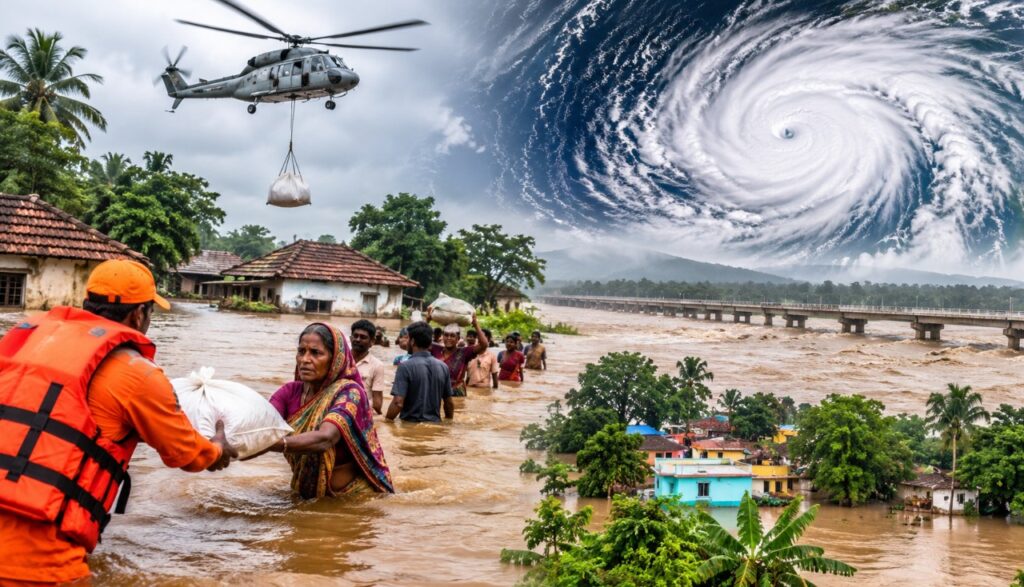
The flooding of Ganjam and Gajapati districts following torrential rainfall triggered by Cyclone Arnab highlights a familiar but increasingly complex challenge in Odisha’s disaster management: the danger does not necessarily end when a cyclone weakens or moves away. In many instances, the most serious consequences emerge afterwards, when swollen rivers, saturated catchments and continuing rainfall combine to inundate settlements far from the immediate coastal impact zone.
Rushikulya and Bansadhara
The Rushikulya and Bansadhara rivers are central to understanding the present situation. Both rivers drain substantial catchment areas and respond to heavy rainfall across their upper reaches. When intense precipitation occurs over the hills and adjoining catchments, enormous volumes of water flow downstream. The resulting rise in river levels can overwhelm riverbanks, inundate low-lying settlements and submerge agricultural land.
Gajapati, with its hilly terrain, is particularly vulnerable to rapid runoff and sudden rises in streams and rivers. Water flowing down the Eastern Ghats can reach lower elevations quickly, creating flash-flood conditions. Similarly, Ganjam faces the combined risks of riverine flooding, inundation of low-lying areas and drainage congestion.
This explains why the impact of heavy rainfall need not remain confined to the areas where the rain actually falls. Rivers carry the consequences of rainfall across geographical boundaries. A village experiencing flooding may be located several kilometres away from the place where the heaviest precipitation occurred.
Three factors make the situation particularly challenging.
The first is saturated soil and accumulated rainfall. After prolonged and intense rainfall, the soil loses much of its capacity to absorb additional water. A larger proportion of subsequent rainfall therefore becomes surface runoff, flowing into streams, tributaries and rivers. Even moderate additional rainfall can consequently aggravate flooding.
The second is the movement of water from distant catchments. The Rushikulya and Bansadhara rivers are not confined to individual districts. Their catchments extend across different geographical and topographical zones. Rainfall in the upper catchments can translate into rising water levels downstream, sometimes after a considerable time lag.
This creates a serious forecasting challenge. The location receiving the heaviest rainfall may not necessarily be the location experiencing the worst flooding.
The third factor is disrupted connectivity. Once roads, bridges and rural access routes are submerged, conventional relief operations become difficult. This explains the deployment of four Navy and Coast Guard helicopters to airdrop food packets at 21 identified locations in Ganjam.
The use of boats to distribute cooked food is equally important. Aerial supplies can provide emergency assistance, but sustained relief requires ground-level distribution of food, drinking water and medicines, along with evacuation wherever necessary.
Another Cyclone?
Even as Odisha deals with the aftermath of Cyclone Arnab, another weather system is developing over the Bay of Bengal.
According to the IMD bulletin issued on October 31, the well-marked low-pressure area over the southeast Bay of Bengal and adjoining Andaman region was likely to intensify into a depression within six hours and subsequently into a cyclonic storm during the following 24 hours. It was expected to move west-northwestwards towards the Andhra Pradesh coast, reaching the west-central Bay of Bengal near the coast around the evening of November 2.
This development deserves attention for two reasons. First, the southern districts of Odisha are already dealing with extensive flooding. Further rainfall could delay the recession of floodwaters and complicate rescue operations.
Second, the new system’s eventual movement and intensity will determine the distribution of rainfall across southern Odisha and neighbouring Andhra Pradesh. Its precise impact on Odisha will become clearer as the system develops. Importantly, the IMD forecast of an approaching cyclonic storm does not, at this stage, establish a landfall in Andhra Pradesh or Odisha.
Difficult to Anticipate?
This is perhaps the most important question. Cyclone forecasting and flood forecasting are related but different exercises. Meteorologists track a cyclone’s movement, wind speed, intensity and rainfall potential. Flood forecasting requires additional information, including rainfall across the entire river basin, reservoir releases, river discharge, soil saturation, drainage conditions and the capacity of rivers to carry excess water.
A cyclone may weaken considerably after moving inland, but its associated rainfall can continue to produce serious consequences.
In Odisha’s case, the challenge is compounded by the state’s varied geography. The Eastern Ghats, river valleys, coastal plains and low-lying settlements respond differently to intense rainfall. A warning issued for an entire district does not necessarily communicate the precise risk faced by individual villages.
The experience also underlines the need for better coordination among the IMD, Central Water Commission, state Water Resources authorities and district administrations.
Larger Lesson
Odisha has developed considerable institutional capacity in cyclone preparedness since the devastating Super Cyclone of 1999. Early warnings, evacuation measures, cyclone shelters and coordinated emergency responses have substantially strengthened the state’s disaster management framework.
However, the present crisis points to another dimension of disaster preparedness: managing the aftermath of cyclones, particularly riverine floods.
The emphasis must move beyond evacuating people before a cyclone makes landfall. It must also include real-time river monitoring, village-level flood warnings, identification of vulnerable settlements, protection of drinking water sources and contingency arrangements for prolonged isolation.
The government must also ensure that relief operations do not end with the distribution of food packets. Damaged houses, destroyed crops, livestock losses, contaminated drinking water and disrupted livelihoods require systematic assessment and rehabilitation.
The larger lesson is that a cyclone is not merely a coastal disaster. Its impact travels inland through rivers, rainfall and disrupted livelihoods. For Ganjam and Gajapati, the immediate challenge is rescue and relief. For Odisha, the longer-term challenge is to build a disaster management system that anticipates not just the cyclone but also the floods that follow it.
(The author is a senior journalist and columnist. Views expressed are personal.)